
New Safety of Life SDD v3.3 Release
March 26, 2019The new version of the Service Definition Document (SDD) for the EGNOS Safety of Life service has been published today!

Croatia Airlines will use EGNOS for satellite LPV approaches
March 25, 2019Croatia Airlines has successfully completed the major part of the DASH Q400 aircraft modernization project in which Dash aircraft are equipped with new navigation equipment.

GSA highlights added value of EGNSS for drones at WATM 2019
March 21, 2019The added value of EGNSS (Galileo and EGNOS) for drones was the focus of a special session organised by the European GNSS Agency (GSA) at this year’s World ATM Congress in Madrid on 12 March, at which representatives from several projects spoke about how they are benefitting from the European space programme.
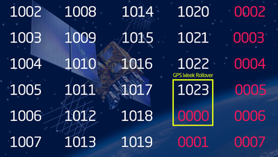
Take action: GPS Week Rollover is coming!
March 19, 2019If you haven’t heard of the GPS Week Rollover and its potentially critical consequences, or haven’t taken any action, now it is the time to do so, and you can do it by reading this article. Due to this GPS event and its effects, explained hereinafter, EGNOS encourages all its users to check their GPS receivers.
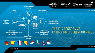
Iris programme to modernise European air traffic management enters implementation phase
March 15, 2019Ground-breaking programme, led by Inmarsat in partnership with the European Space Agency (ESA), will reduce flight delays, save fuel and benefit the environment

ESSP shareholders sign a joint statement to continue give full support to EGNOS and to the European PBN regulation
March 12, 2019The 7 Air Navigation Service Providers (ANSPs) of France, Germany, Italy, Portugal, Spain, Switzerland, and the United Kingdom in their role of ESSP-SAS (European Satellite Service Provider) founders came together to sign a joint letter, which outlines their commitment to continuing their support to EGNOS, a program from the European Union managed by the European GNSS Agency (GSA).
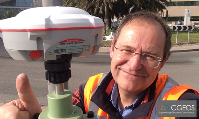
CGEOS Creative Geosensing relies on EGNOS for engineering geodesy solutions
March 11, 2019CGEOS Creative Geosensing is a Belgian company specialized in engineering geodesy and high precision positioning applications. CGEOS was founded by Professor Joël van Cranenbroeck in January 2014, taking advantage of his long-term (more than 30 years) experience with GNSS technology acquired at the Belgian National Geographic Institute along with other professional experiences. CGEOS addresses three major market segments at an international level: engineering geodesy consultancy services, GNSS high accuracy positioning and GNSS monitoring of human-made structures and natural elements. CGEOS delivers these services to both the public and private sectors, not only in Belgium but worldwide.

EGNOS, an ongoing story for aviation
February 19, 2019EGNOS is reaching the impressive 70 EGNOS WORKING AGREEMENTS established with Air Navigation Service Providers
